Category Archives: Outdoor equipment
Bergverlag Rother – Dolomiten 7 – Walking guide book
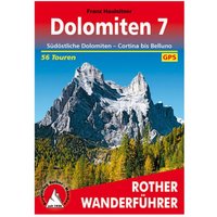
Bergverlag Rother – Dolomiten 7 – Walking guide book. Author: Franz Hauleitner|Publisher: Bergverlag Rother|Number of pages: 176|Language: German|Language: German
Tasmanian Tiger – TT Tac Pouch 5.1 – Bag size One Size, green
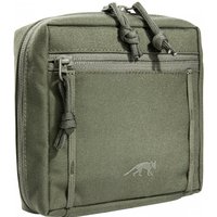
Tasmanian Tiger – TT Tac Pouch 5.1 – Bag. Additional features: front zip pocket|Dimensions (outer): 15 x 15 x 6 cm|Reference size: medium size
Supertopo – Northern California Bouldering – Bouldering guide
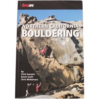
Supertopo – Northern California Bouldering – Bouldering guide. Author: Chris Summit|Publisher: Supertopo|Number of pages: 224|Language: English|Language: English
Bergverlag Rother – Vierwaldstättersee – Walking guide book 9. Auflage 2020
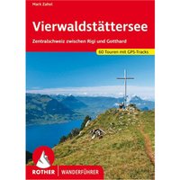
Bergverlag Rother – Vierwaldstättersee – Walking guide book. Publisher: Bergverlag Rother|Year: 2,020|Number of pages: 232|Language: German|Scale: 1:50,000|Scale: 1:75,000|Scale: 1:1,000,000|Format: portrait|Scale: 1:50,000|Scale: 1:75,000|Language: German
Panico Alpinverlag – Die Anden – Alpine guide
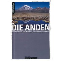
Panico Alpinverlag – Die Anden – Alpine guide. Author: Hermann Kiendler|Publisher: Panico Alpinverlag|Year: 2,015|Edition: 2nd ed.|Number of pages: 372|Language: German|Language: German
Panico Alpinverlag – Verwegen, dynamisch, erfolglos – Roman
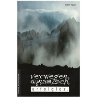
Panico Alpinverlag – Verwegen, dynamisch, erfolglos – Roman. Author: Robert Rauch|Publisher: Panico Alpinverlag|Year: 2,009|Edition: 6th ed.|Number of pages: 260|Language: German|Language: German
Stabilotherm – BBQ Grid – Solid fuel stoves size Medium, stainless steel
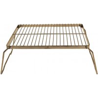
Stabilotherm – BBQ Grid – Solid fuel stoves. Material type: stainless steel|Fuel types: dry fuel|Dimensions (outer): 16 x 16 cm (grill surface); 12.5 cm (height)|Packed dimensions: 16 x 16 cm|Includes: incl. Luggage|Misc: folding feet
Stabilotherm – BBQ Grid – Solid fuel stoves size Small, stainless steel
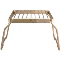
Stabilotherm – BBQ Grid – Solid fuel stoves. Material type: stainless steel|Fuel types: dry fuel|Dimensions (outer): 16 x 16 cm (grill surface); 12.5 cm (height)|Packed dimensions: 16 x 16 cm|Includes: incl. Luggage|Misc: folding feet
Kompass – Würzburg, Maindreieck – Hiking map 1. Auflage 2020
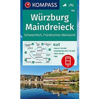
Kompass – Würzburg, Maindreieck – Hiking map. Publisher: Kompass|Year: 2,020|Language: German|Scale: 1:50,000|Scale: 1:25,000|Misc: 4in1 walking map with active guide and detailed maps incl. map for offline use in the Kompass app; walking; cycling|Scale: 1:25,000|Scale: 1:50,000|Language: German
Kompass – Spessart mit Frankfurt am Main – Walking guide book 1. Auflage – Neuausgabe
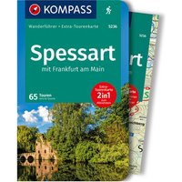
Kompass – Spessart mit Frankfurt am Main – Walking guide book. Author: Astrid Sturm|Publisher: Kompass|Year: 2,019|Number of pages: 256|Format: portrait|Misc: Extra map 1:60,000; 65 routes; GPX data for download
Bergverlag Rother – Moselhöhenweg – Walking guide book
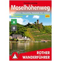
Bergverlag Rother – Moselhöhenweg – Walking guide book. Author: Thorsten Lensing|Publisher: Bergverlag Rother|Number of pages: 152|Language: German|Language: German
Bergverlag Rother – Niederlande – Walking guide book
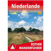
Bergverlag Rother – Niederlande – Walking guide book. Author: Pieter-Paul van Laake|Publisher: Bergverlag Rother|Year: 2,011|Number of pages: 192|Language: German|Language: German
Bergverlag Rother – Ungarn – West – Walking guide book
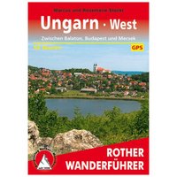
Bergverlag Rother – Ungarn – West – Walking guide book. Author: Marcus und Rosemarie Stöckl|Publisher: Bergverlag Rother|Year: 2,011|Number of pages: 192|Language: German|Language: German
SAC-Verlag – Kantonshöhepunkte – Alpine Club guide 1. Auflage 2018
SAC-Verlag – Kantonshöhepunkte – Alpine Club guide. Author: Günter Joos|Publisher: SAC|Year: 2,018|Number of pages: 300|Format: portrait
Kompass – Alpi di Ledro, Valli Giudicarie – Hiking map 1. Auflage – Neuausgabe
Kompass – Alpi di Ledro, Valli Giudicarie – Hiking map. Publisher: Kompass|Year: 2,018|Number of pages: 52|Format: portrait|Misc: scale 1:35,000; tear and weatherproof paper; active guide included; can be used with Kompass app
Kompass – Ammersee, Wörthsee, Pilsensee – Hiking map 1. Auflage – Neuausgabe
Kompass – Ammersee, Wörthsee, Pilsensee – Hiking map. Publisher: Kompass|Year: 2,019|Scale: 1:25,000|Format: portrait|Misc: tear and waterproof paper; active guide included; Map can be used with Kompass app|Scale: 1:25,000
Kompass – Hamburg, Altes Land – Hiking map 1. Auflage – Neuausgabe
Kompass – Hamburg, Altes Land – Hiking map. Publisher: Kompass|Year: 2,019|Format: portrait|Misc: tear and weatherproof paper; detailed maps and active guide included; can be used with Kompass app
Kompass – Waldkirch, Kandel, St.Peter, St. Märgen – Hiking map 1. Auflage – Neuausgabe
Kompass – Waldkirch, Kandel, St.Peter, St. Märgen – Hiking map. Publisher: Kompass|Year: 2,019|Format: portrait|Misc: tear and weatherproof paper; active guide included; can be used with Kompass app
Kompass – Steirisches Hügel-, Vulkan- u. Thermenland – Hiking map Karte / Gefaltet / Kunststoff

Kompass – Steirisches Hügel-, Vulkan- u. Thermenland – Hiking map. Scale: 1:50,000|Format: portrait|Scale: 1:50,000
Kompass – Augsburg, Westliche Wälder – Hiking map 1. Auflage 2020
Kompass – Augsburg, Westliche Wälder – Hiking map. Publisher: Kompass|Year: 2,020|Language: German|Scale: 1:25,000|Scale: 1:50,000|Misc: 4in1 walking map with active guide and detailed maps incl. map for offline use in the Kompass app; 120 x 200 mm|Scale: 1:50,000|Scale: 1:25,000|Language: German