Category Archives: Outdoor equipment
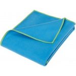
Stoic – Trekking TowelSt. Microfiber Basic – Microfiber towel size XL, green
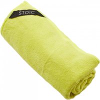
Stoic – Trekking TowelSt. Microfiber Basic – Microfiber towel. Material type: microfibre|Other material information: 200 g/m²|Dimensions (outer): S: 30 x 60 cm; M: 50 x 90 cm; L: 60 x 120 cm; XL: 80 x 140 cm|Extras: incl. stuff sack|Misc: S: 40 g; M: 95 g; L: 150 g; XL: 245 g
Ordnance Survey – Upper Lough Erne (Lisnaskea) – Hiking map Ausgabe 2019
Ordnance Survey – Upper Lough Erne (Lisnaskea) – Hiking map. Publisher: Ordnance Survey|Year: 2,011|Number of pages: 2|Scale: 1:50,000|Format: portrait|Scale: 1:50,000
Ordnance Survey – Wensleydale / Upper Wharfedale – Hiking map Ausgabe 2016
Ordnance Survey – Wensleydale / Upper Wharfedale – Hiking map. Publisher: Ordnance Survey|Year: 2,016|Number of pages: 1|Scale: 1:50,000|Format: portrait|Scale: 1:50,000
Ordnance Survey – West London / Rickmansworth / Staines – Hiking map Ausgabe 2016

Ordnance Survey – West London / Rickmansworth / Staines – Hiking map. Publisher: Ordnance Survey|Year: 2,016|Number of pages: 1|Scale: 1:50,000|Format: portrait|Scale: 1:50,000
Ordnance Survey – Weston-Super-Mare – Hiking map Ausgabe 2016
Ordnance Survey – Weston-Super-Mare – Hiking map. Publisher: Ordnance Survey|Year: 2,016|Number of pages: 1|Scale: 1:50,000|Format: portrait|Scale: 1:50,000
Ordnance Survey – Winchester / Basingstoke – Hiking map Ausgabe 2016
Ordnance Survey – Winchester / Basingstoke – Hiking map. Publisher: Ordnance Survey|Year: 2,016|Number of pages: 1|Scale: 1:50,000|Format: portrait|Scale: 1:50,000
Ordnance Survey – Winchester / New Alresford / East Meon Outdoor – Hiking map Ausgabe 2015

Ordnance Survey – Winchester / New Alresford / East Meon Outdoor – Hiking map. Publisher: Ordnance Survey|Year: 2,015|Number of pages: 1|Scale: 1:25,000|Format: portrait|Scale: 1:25,000
Ordnance Survey – Worcester / The Malverns – Hiking map Ausgabe 2016
Ordnance Survey – Worcester / The Malverns – Hiking map. Publisher: Ordnance Survey|Year: 2,016|Number of pages: 1|Scale: 1:50,000|Format: portrait|Scale: 1:50,000
Ordnance Survey – Yeovil / Frome – Hiking map Ausgabe 2017
Ordnance Survey – Yeovil / Frome – Hiking map. Publisher: Ordnance Survey|Year: 2,017|Number of pages: 1|Scale: 1:50,000|Format: portrait|Scale: 1:50,000
Ordnance Survey – York / Selby – Hiking map Ausgabe 2016
Ordnance Survey – York / Selby – Hiking map. Publisher: Ordnance Survey|Year: 2,016|Number of pages: 1|Scale: 1:50,000|Format: portrait|Scale: 1:50,000
Ordnance Survey – Yorkshire Dales – Southern & Western Areas Outdoor – Hiking map Ausgabe 2016
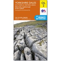
Ordnance Survey – Yorkshire Dales – Southern & Western Areas Outdoor – Hiking map. Publisher: Ordnance Survey|Year: 2,016|Number of pages: 2|Scale: 1:25,000|Format: portrait|Scale: 1:25,000
Ordnance Survey – Mansfield / Worksop / Sherwood Forest – Hiking map Ausgabe 2016
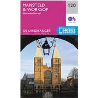
Ordnance Survey – Mansfield / Worksop / Sherwood Forest – Hiking map. Publisher: Ordnance Survey|Year: 2,016|Number of pages: 1|Scale: 1:50,000|Format: portrait|Scale: 1:50,000
VEER – Dining Table size One Size, schwarz

VEER – Dining Table. Material type: plastic|Misc: two cup holders
Ordnance Survey – Upper Clyde Valley – Hiking map Ausgabe 2016
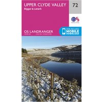
Ordnance Survey – Upper Clyde Valley – Hiking map. Publisher: Ordnance Survey|Year: 2,016|Number of pages: 1|Scale: 1:50,000|Format: portrait|Scale: 1:50,000
Ordnance Survey – Stafford / Telford – Hiking map Ausgabe 2017
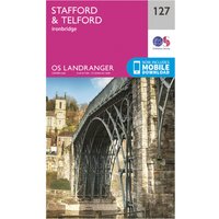
Ordnance Survey – Stafford / Telford – Hiking map. Publisher: Ordnance Survey|Year: 2,017|Number of pages: 1|Scale: 1:50,000|Format: portrait|Scale: 1:50,000
Ordnance Survey – St-David’s / Haverfordwest – Hiking map Ausgabe 2016
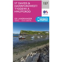
Ordnance Survey – St-David’s / Haverfordwest – Hiking map. Publisher: Ordnance Survey|Year: 2,016|Number of pages: 1|Scale: 1:50,000|Format: portrait|Scale: 1:50,000
Ordnance Survey – Stonehaven / Banchory – Hiking map Ausgabe 2016
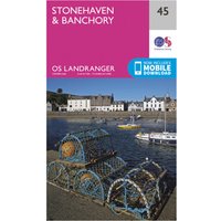
Ordnance Survey – Stonehaven / Banchory – Hiking map. Publisher: Ordnance Survey|Year: 2,016|Number of pages: 1|Scale: 1:50,000|Format: portrait|Scale: 1:50,000
Ordnance Survey – Strabane – Hiking map Ausgabe 2013
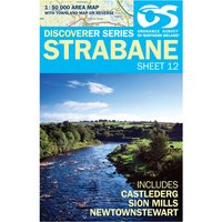
Ordnance Survey – Strabane – Hiking map. Publisher: Ordnance Survey|Year: 2,013|Number of pages: 2|Scale: 1:50,000|Format: portrait|Scale: 1:50,000
Ordnance Survey – Strangford Lough – Hiking map Ausgabe 2011
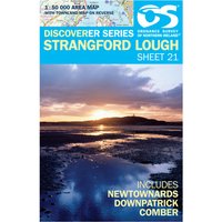
Ordnance Survey – Strangford Lough – Hiking map. Publisher: Ordnance Survey|Year: 2,011|Number of pages: 2|Scale: 1:50,000|Format: portrait|Scale: 1:50,000
Ordnance Survey – Stranraer / Glenluce – Hiking map Ausgabe 2016
Ordnance Survey – Stranraer / Glenluce – Hiking map. Publisher: Ordnance Survey|Year: 2,016|Number of pages: 1|Scale: 1:50,000|Format: portrait|Scale: 1:50,000