Category Archives: Outdoor equipment
Ordnance Survey – Luton / Hertford / Hitchin / St Albans – Hiking map Ausgabe 2016

Ordnance Survey – Luton / Hertford / Hitchin / St Albans – Hiking map. Publisher: Ordnance Survey|Year: 2,016|Number of pages: 1|Scale: 1:50,000|Format: portrait|Scale: 1:50,000
Ordnance Survey – Manchester – Hiking map Ausgabe 2016

Ordnance Survey – Manchester – Hiking map. Publisher: Ordnance Survey|Year: 2,016|Number of pages: 1|Scale: 1:50,000|Format: portrait|Scale: 1:50,000
Ordnance Survey – Market Weighton – Hiking map Ausgabe 2016

Ordnance Survey – Market Weighton – Hiking map. Publisher: Ordnance Survey|Year: 2,016|Number of pages: 1|Scale: 1:50,000|Format: portrait|Scale: 1:50,000
Ordnance Survey – Meon Valley, Portsmouth, Gosport & Fareham Areas Outdoor – Hiking map Ausgabe 2015
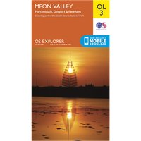
Ordnance Survey – Meon Valley, Portsmouth, Gosport & Fareham Areas Outdoor – Hiking map. Publisher: Ordnance Survey|Year: 2,015|Number of pages: 1|Scale: 1:25,000|Format: portrait|Scale: 1:25,000
Ordnance Survey – Minehead / Brendon Hills – Hiking map Ausgabe 2016
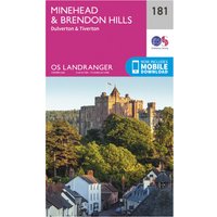
Ordnance Survey – Minehead / Brendon Hills – Hiking map. Publisher: Ordnance Survey|Year: 2,016|Number of pages: 1|Scale: 1:50,000|Format: portrait|Scale: 1:50,000
Ordnance Survey – Monaghan-Keady (Castleblayney) – Hiking map Ausgabe 2017
Ordnance Survey – Monaghan-Keady (Castleblayney) – Hiking map. Publisher: Ordnance Survey|Year: 2,017|Number of pages: 2|Scale: 1:50,000|Format: portrait|Scale: 1:50,000
Ordnance Survey – Nairn / Forres – Hiking map Ausgabe 2016
Ordnance Survey – Nairn / Forres – Hiking map. Publisher: Ordnance Survey|Year: 2,016|Number of pages: 1|Scale: 1:50,000|Format: portrait|Scale: 1:50,000
Ordnance Survey – Newbury / Wantage – Hiking map Ausgabe 2016
Ordnance Survey – Newbury / Wantage – Hiking map. Publisher: Ordnance Survey|Year: 2,016|Number of pages: 1|Scale: 1:50,000|Format: portrait|Scale: 1:50,000
Ordnance Survey – Newcastle Upon Tyne – Hiking map Ausgabe 2016
Ordnance Survey – Newcastle Upon Tyne – Hiking map. Publisher: Ordnance Survey|Year: 2,016|Number of pages: 1|Scale: 1:50,000|Format: portrait|Scale: 1:50,000
Ordnance Survey – Newquay / Bodmin – Hiking map Ausgabe 2016
Ordnance Survey – Newquay / Bodmin – Hiking map. Publisher: Ordnance Survey|Year: 2,016|Number of pages: 1|Scale: 1:50,000|Format: portrait|Scale: 1:50,000
Ordnance Survey – Loch Lomond / Inveraray – Hiking map Ausgabe 2016
Ordnance Survey – Loch Lomond / Inveraray – Hiking map. Publisher: Ordnance Survey|Year: 2,016|Number of pages: 1|Scale: 1:50,000|Format: portrait|Scale: 1:50,000
Ordnance Survey – Newton Stewart / Kirkcudbright – Hiking map Ausgabe 2016
Ordnance Survey – Newton Stewart / Kirkcudbright – Hiking map. Publisher: Ordnance Survey|Year: 2,016|Number of pages: 1|Scale: 1:50,000|Format: portrait|Scale: 1:50,000
Ordnance Survey – Lochindorb / Grantown-On-Spey Outdoor – Hiking map Ausgabe 2015
Ordnance Survey – Lochindorb / Grantown-On-Spey Outdoor – Hiking map. Publisher: Ordnance Survey|Year: 2,015|Number of pages: 1|Scale: 1:25,000|Format: portrait|Scale: 1:25,000
Ordnance Survey – Newtown /Lllanidloes – Hiking map Ausgabe 2016
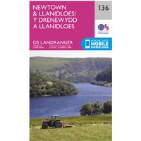
Ordnance Survey – Newtown /Lllanidloes – Hiking map. Publisher: Ordnance Survey|Year: 2,016|Number of pages: 1|Scale: 1:50,000|Format: portrait|Scale: 1:50,000
Ordnance Survey – Kidderminster / Wyre Forest – Hiking map Ausgabe 2018
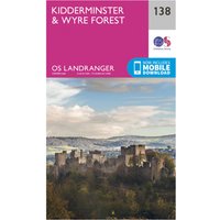
Ordnance Survey – Kidderminster / Wyre Forest – Hiking map. Publisher: Ordnance Survey|Year: 2,018|Number of pages: 1|Scale: 1:50,000|Format: portrait|Scale: 1:50,000
Ordnance Survey – Kielder Water / Forest/Bellingham/Simonside Hills Outdoor – Hiking map Ausgabe 2015
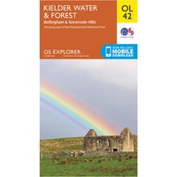
Ordnance Survey – Kielder Water / Forest/Bellingham/Simonside Hills Outdoor – Hiking map. Publisher: Ordnance Survey|Year: 2,015|Number of pages: 2|Scale: 1:25,000|Format: portrait|Scale: 1:25,000
Ordnance Survey – Kingston Upon Hull – Hiking map Ausgabe 2016
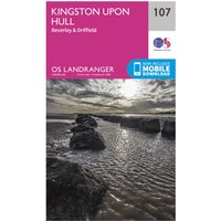
Ordnance Survey – Kingston Upon Hull – Hiking map. Publisher: Ordnance Survey|Year: 2,016|Number of pages: 1|Scale: 1:50,000|Format: portrait|Scale: 1:50,000
Ordnance Survey – Kingussie / Monadhliath Mountains – Hiking map Ausgabe 2016
Ordnance Survey – Kingussie / Monadhliath Mountains – Hiking map. Publisher: Ordnance Survey|Year: 2,016|Number of pages: 1|Scale: 1:50,000|Format: portrait|Scale: 1:50,000
Ordnance Survey – Lampeter / Llandovery – Hiking map Ausgabe 2016
Ordnance Survey – Lampeter / Llandovery – Hiking map. Publisher: Ordnance Survey|Year: 2,016|Number of pages: 1|Scale: 1:50,000|Format: portrait|Scale: 1:50,000
Ordnance Survey – Lanark / Upper Nithsdale – Hiking map Ausgabe 2016
Ordnance Survey – Lanark / Upper Nithsdale – Hiking map. Publisher: Ordnance Survey|Year: 2,016|Number of pages: 1|Scale: 1:50,000|Format: portrait|Scale: 1:50,000